Walk Information
Walk location: Tealby is 4 miles north-east of Market Rasen
Starting Point: Memorial Hall, Beck Hill, Tealby
Grid Reference: TF 158 908
Postcode: LN8 3XS
What3Words: variances.deprive.reporting
Parking: Please park responsibly in the village
Public transport: For information call the Traveline on 08712 002233 or visit www.lincsbus.info
Walk length: 7km (4.4 miles)
At a leisurely pace, this walk will take approximately 2 hours to complete.
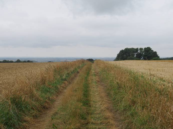
Type of walk: The walks use a mixture of surfaced paths, tracks, field paths and roads. There are no stiles but you may encounter livestock.
Ordnance Survey maps: Explorer 282 Lincolnshire Wolds North
Refreshments: Tealby Village Shop, The Kings Head pub, and Vintage Tearooms
For more information about Tealby, visit the Tealby website.
Introduction
Welcome to Tealby! The cosy village you see now was once a large settlement in early medieval documentation, with 52.5 households recorded in the Domesday Book as the village of 'Tevelsby' – this number put it in the top 20% largest villages in the country at the time! This grew to 97 households in the 16th century, but shrank a little again by the 19th century. Now it has a population of about 600 people, but we can see the remains of where the village once stretched further out. Lumps and bumps from ancient houses and field systems can be seen if you know where to look around the village…
Tealby sits within the nationally protected Lincolnshire Wolds Area of Outstanding Natural Beauty (AONB). Designated in 1973 the AONB covers 216 square miles and includes rolling hills, hidden valleys, gentle streams and nestling villages. More information can be found at www.lincswolds.org.uk
Download map: Viking Shorts - Tealby
Text only: Vikings Shorts - Tealby
Walk Directions
Begin your walk from Memorial Hall.
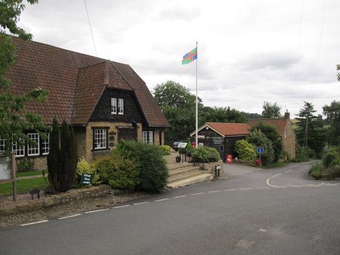
It is hard to talk about Tealby without mentioning the Tennyson family. This Memorial Hall which now serves as a local village community hall was gifted to the village by the Tennyson D'Eyncourt family as memorial to the family members who died during the First World War. There were many famous and celebrated individuals of the family too, some of whom are nationally recognised household names today! As you walk around the village itself you may spot many references to the Tennysons, which speaks of their influence and wealth over the last 200 years.
1. With your back to the hall, turn right to the crossroads.
Cross the road with care and continue ahead along Caistor Lane.
Along Caistor Lane we get a taste of what the Tealby of the 1700 and 1800s would have felt like. The Vicarage is the first house on the corner. It dates to the late 1700s and was constructed in the local ironstone. Next to it is the old curate's cottage, built a few years after the Vicarage, and also constructed from the local limestone. These have both been listed due to their special architectural and historic interest. The next cottage along is also listed – this is Stockshill Cottage. As you walk up the lane it is clear why 'hill' is in the name! But 'Stocks' is more difficult… Perhaps named for a nearby stocks pillory, or perhaps named after a local family – the name gives us only a hint of the lives lived just a couple of hundred years ago. Opposite this snapshot of post-medieval Tealby life is the All Saints Church and its Churchyard.
2. Turn left and walk towards the Church.
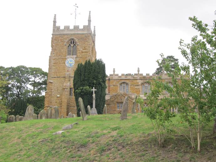
One of the first things that is striking about the Church is that it is also made of the local limestone. It dates from the 12th century, with alterations in the 13th, early 14th, 15th and 16th centuries. Some architectural features of the church suggest there may well have been an even older church on the spot before the 12th century, perhaps made of wood. The chancel was remodelled in 1872 and the tower was restored in 1881-84. The first known vicar was a man named Alan of Tevelsby, appointed in 1220. The oldest parts of the church, which Alan may have seen, are the west doorway and the lower part of the tower. As with many other churches around the country, we can get an idea for the important goings on in Tealby over the last few hundred years from its Church, including memorials to various members of the Tennyson family. Why not take a stroll around the churchyard and take in all the details.
Travelling up the hill, we find ourselves in the post-medieval Tealby we can still glimpse if we look back down Caistor Lane. To the left is the house that used to be the village smithy. Like the Vicarage, it was important enough to be recorded on the old maps. Carrying on down the lane we pass the site of what used to be the Vicarage, before the 'new' one was built on Caistor Lane. We no longer know its precise location but we can imagine how often this footpath was used by the people of Tealby before us, traveling to and fro between the Church and the Vicarage.
3. After approximately 55m turn right onto a public footpath.
Walk past the house at the end of the lane and then straight on through the gate.
As you walk across the field, we jump forward to the 20th century and a time of war, fear and hope. Just to your left are the possible remains of a searchlight battery, which was a site for searchlights to be placed, ready to locate enemy aircraft. As Lincolnshire was a huge target for invading bombers, these searchlight batteries were essential to protect locals and their land. This battery was identified from aerial photographs, but if you look closely you can make out some faint lumps in the grass, perhaps these mark the place where soldiers once kept watch over Tealby.
Walk across the field to the right end of the hedge in the middle of the field. Bear diagonally right to the field corner. Go through the gate and walk straight ahead along the field edge.
 As you reach the hedgeline, to your left on a swell of the hill over the way are the remains of ridge and furrow. Ridge and furrow is a common sight in this country, but it is becoming less and less common because of industrialised farming. They are the earthwork remains of medieval and post-medieval farmers, usually the tenant farmers and everyday people of the local village, who worked strips of land with their traditional ploughs. Because these ploughs couldn't be reversed, they turned the soil over to the right, creating the trough and peak lines on the landscape we see today.
4. At the end of the second field go through the gate and bear diagonally right across the field. At the hedge turn right and follow the field edge path to the road.
The farmstead to the left here is North Wold Farm, which was built in response to the enclosure of Tealby in 1795, when the common land was broken up and 77 acres were allotted to William Carr. North Wold Farm was built at the centre of his plot. Before the 1795 Enclosure two thirds of the land were farmed as open field systems. Afterwards the open fields were allotted to landowners, including George Tennyson, who became owner of a third of the land around Tealby. This meant many of the people of Tealby lost their strips of ridge and furrow, their means of getting food on their family table.
5. At the road turn left and follow it for approximately 520m.
Look out for the large majestic beech tree on the opposite side of the road. The trunk has smooth grey bark and in Spring the newly emerged leaves are delicate and bright green. It is known as the queen of British trees.
Check out the grass verges for wildflowers. Roadside verges in the Wolds are often wide and home to a range of wildflowers. Wildflower verges of nature importance are designated Roadside Nature Reserves.
6. Turn left onto a public bridleway and track and follow it across countryside.
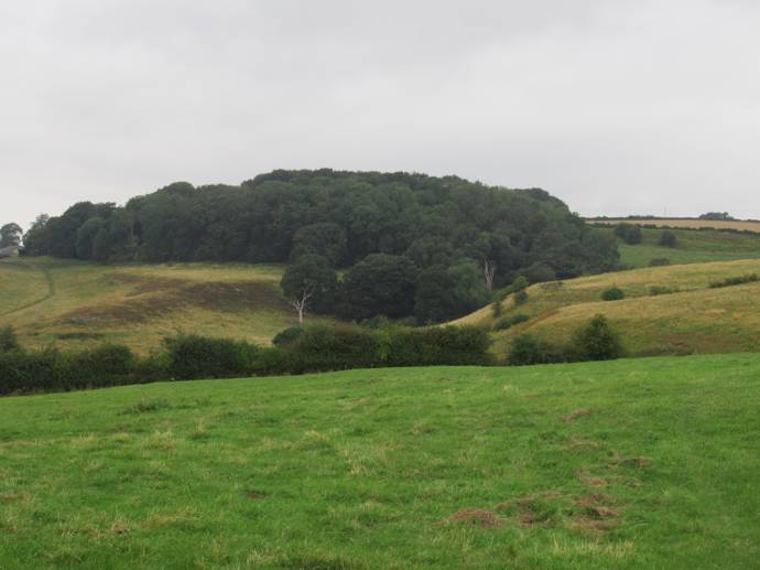
Along this track we go further back in time to prehistoric Tealby. A flint scraper was discovered to the right of the track, which is now held in Lincoln museum. And just a little further away is a ploughed out earthwork mound, which may have been a Neolithic long barrow, a place for the people in the area to bury their dead up to 6000 years ago.
Later, the Romans made their mark right here on the landscape too. A Roman villa was discovered and excavated in 1861 in the same area as the long barrow. The people who lived there were probably fairly well off as part of a hypocaust system was found in the building, providing warmth and hot water to their lives. Lots of pottery was found in the surrounding area, and though it's hard to imagine now in such quiet countryside, it was probably a huge and thriving household with lots of comings and goings, including vehicles like carts bustling across the Wolds.
Keep following the track as it winds its way between houses.
You may notice that the house ahead is named Risby Manor House. It's a farmhouse constructed in 1835 of the local ironstone, much like the ones in the village. However this house is named after the medieval village we are about to enter. Risby is a deserted medieval village, sometimes called a DMV, and it leaves behind only earthworks of the crofts and tofts which made up the houses, some ridge and furrow, and the odd pottery sherd which you may be able to spy to the right as you reach the end of the properties and look out over the field where Risby once existed.
7. As you start to descend at the end of the properties, and at the junction with a footpath (Viking Way), turn left through a gate to joint he Viking Way and the return route to Tealby.
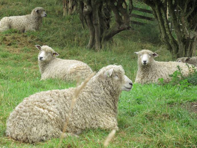
Risby Grange, on your left, is home to a flock of rare breed Lincoln Longwool sheep with their long luscious coats. The Longwool is the largest native sheep breed and was once popular across eastern Britain. Its popularity declined alongside that of the whole wool industry and the demand for cheap meat.
Walk straight ahead, cross the driveway and go through the gate. Bear right uphill to a gate in the field corner.
8. Go through the gate, turn right and follow the path along the wood edge.
Look closely and you will see that the wood is made up of a variety of tree species including oak, ash and beech. Oak is known as the king of British trees, its timber is strong and durable and widely used in construction. It was probably used in the construction of many of the buildings we have already seen.
9. At the end of the wood follow the path by bearing left downhill to the bottom of the valley.
As you head down the hill, you may notice the farm to your right. It has brick battlements, as though ready to defend against a medieval army. Though it is called Castle Farm, this building was only built in the 19th century as a farmhouse, and the 'curtain wall' was added later during a 'Gothic Revival' remodelling. This was probably related to the construction of Bayons Manor, the grand but now ruined manor belonging to the Tennysons, from which Castle Farm could have been seen on the landscape as a small castle. Sometimes it is difficult to understand the intentions of people in the past, particularly when it comes to things like 'follies', but sometimes the answer is just for the sake of it. The fun and joy of spotting a castle in the distance has been shared by people walking across this landscape for nearly 200 years.
Follow the path along field edges, along a boardwalk to a gate.
Go through the gate and bear slightly left up the slope. Continue along the path to a junction with another path at a waymarker post.
10. Leave the Viking Way here and take the right hand path down the slope to the field corner.
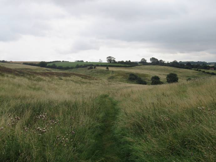
As you head down this slope, you are walking into medieval Tealby. Here are the remains of the medieval field systems, where the people of the village would have busily spent their days. You might be able to make out the lines of the field boundaries and areas of more ridge and furrow, where people worked and made their livelihoods for hundreds of years.
Go through the gate and follow the path to the road
11. Turn right and follow the roadside pavement for approximately 540m.
12. Turn left onto a public footpath beside the Bowling & Tennis Club
At the end of the roadway follow the path around the sewage works.
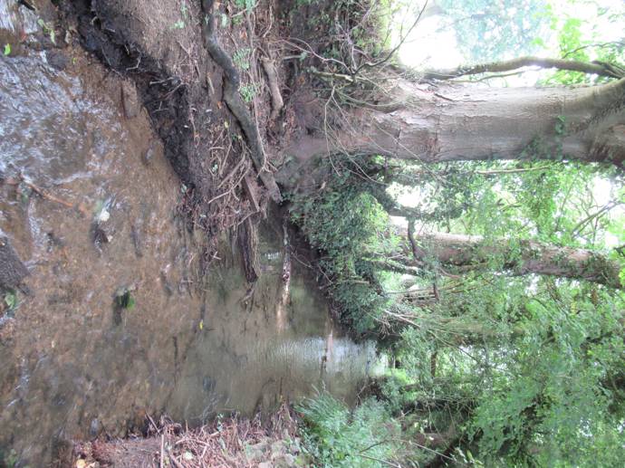
13. At a junction with another path turn left and walk beside the River Rase.
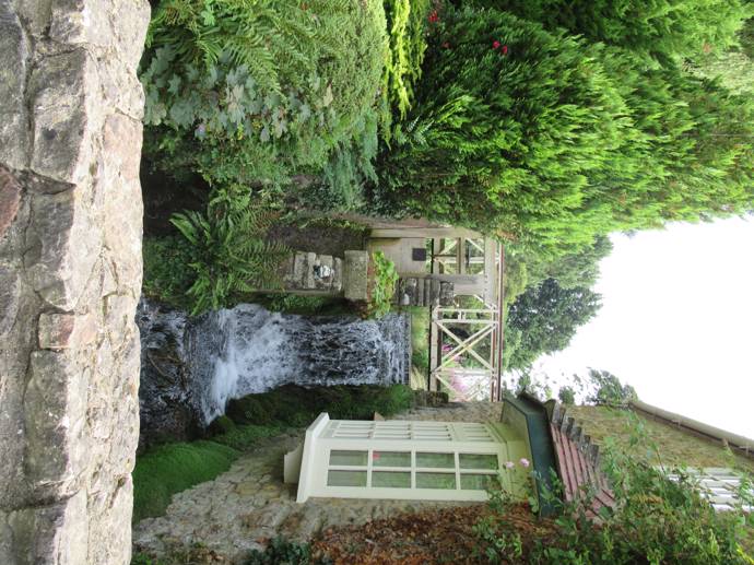
As you reach the River Rase, you will pass the site of a former watermill. It is known from the 1793 Enclosure Map of Tealby that this was located here, but was demolished and replaced sometime in the 19th century. Its name on the mapping was 'Temple Garth', which may suggest earlier medieval origins associated with a local monastery. You may be able to spot the structure now as a pile of overgrown rubble…
The River Rase is a tributary of the River Ancholme. It rises from springs known as Churn Water Heads on Bully Hill just north of Tealby. It flows through Tealby then on to Market Rasen, Middle Rasen and West Rasen and joins the Ancholme near Snitterby.
Go through the gate and continue to follow the path alongside the river to a bridge. Cross the bridge, turn left to a gate and road.
14. Turn left and follow the road into Tealby village.
The first house on the right is another former watermill. This was a water-driven corn mill, which has been converted into a house, though the mill race still remains and can be seen (and heard!) as you walk further along the road.
15. At the T-junction turn right.
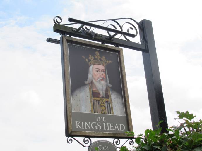
On the right is The King's Head, a 17th century inn with a thatched roof, thought to be Lincolnshire's oldest thatched pub. As you walk back into the heart of Tealby, it is easy to imagine the lives of those living in the 1700s and 1800s, walking from their houses to the pub, to the Vicarage and the Church, or even to fetch something from the Smithy.
16. Turn right along The Smooting.
The Smooting is a Lincolnshire dialect word for a short narrow passage.
At the end of the road continue ahead along the footpath to a road.
17. Turn left and follow the road to the Village Hall and walk starting point.